San Miguel de Allende, Mexico


Tourist Guide to San Miguel de Allende

Getting To San Miguel | History of San Miguel | Tours | Community
Map of San Miguel de Allende | The Sights of San Miguel
Mexico Travel Tips | Useful Spanish Phrases | San Miguel's Weather

San Miguel de Allende Map

San Miguel de Allende is located in the mountainous region of Central Mexico, in the state of Guanajuato. It is located about a 4 hour drive to Mexico City, 1 1/2 hour drive to Guanajuato, and about 2 1/2 hours from Leon. Below are some maps to help you get a better idea of where San Miguel is located.

Satellite Map of Mexico, with States Outlined

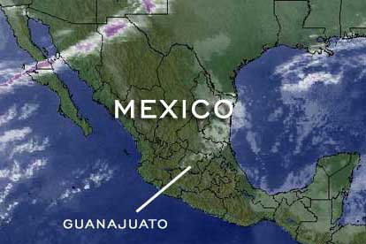
Satellite map of Mexico, with states outlined.

regional highway map for San Miguel de Allende area

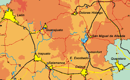
Regional highway map for San Miguel de Allende area adapted from the INEGI touristic map of the state of Guanajuato

San Miguel de Allende Map of the streets in Historic center of San Miguel de Allende

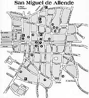
Street map of San Miguel de Allende's historic center,
adapted from the map provided by the COTUR of Guanajuato
Click to open a printable version of the San Miguel de Allende Map of the historic center in new window.


What's New at
Internet San Miguel?

22nd of March: We would like to welcome "ABC Realty" - our latest Real Estate Agency advertiser.

23rd of January: We would like to welcome "Real Estate San Miguel" - our latest Real Estate Agency advertiser.


Internet San Miguel has had visitors since May 1st, 2000